Geomorphology Tools
The Auto Level

The autolevel is an optical surveying instrument useful in the creation of surficial geologic maps. It is, in essence, a fancy telescope with a special crosshair, that when pointed at a ruler in the distance can give you enough information to calculate the distance, elevation, and angle of a given point relative to the autolevel. It is a fully analogue system that makes mapping possible even without electricity or satellite connection.
GPS
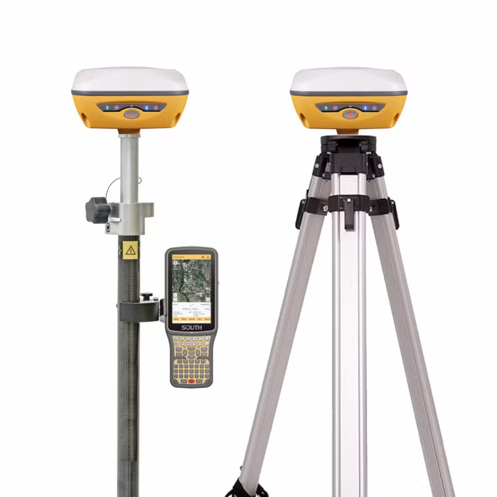
GPS or Global Positioning System, is a satellite-based position, navigation, and timing service. Using a GPS receiver, you can pinpoint your location down to an accuracy of centimeters. In order to pinpoint your position with GPS you need to connect to a minimum of four GPS satellites. The first satellite narrows your position down to a large range of possible values, the second narrows that further to a circle of possible locations, the third narrows that down to just two points, and the fourth eliminates the incorrect points. Further satellite connections can narrow that down further, but the minimum number of connections is 4. GPS is the more advanced, more streamlined system for creating surficial geologic maps using your location in the field.
LiDAR
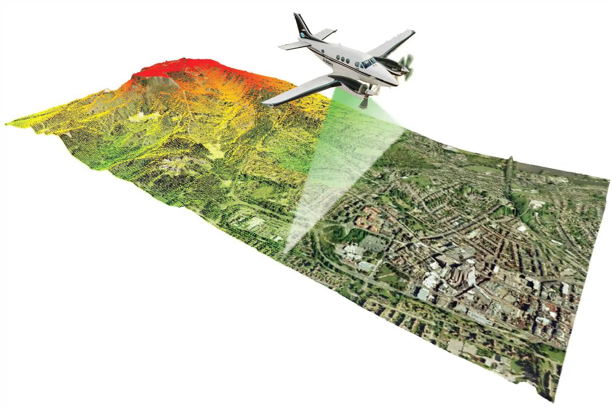
LiDAR or Light Detection and Ranging is a 3D imaging technology that uses pulses of laser light to measure distances. Flying a plane equipped with LiDAR over a landscape can create a detailed elevation model. LiDAR can even see through trees and other vegetation by measuring multiple return intervals of emitted light (the longest return interval usually being the ground i.e. not bouncing off of leaves or branches).
Structure from Motion (SFM)
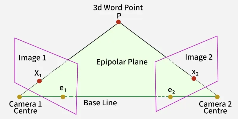
Structure from motion is a 3d aerial mapping technique using pictures taken from various angles, usually with a drone. SFM's main benefit over something like LiDAR is accessibility. It is far cheaper to obtain a drone equipped with a camera than a Cessna equipped with LiDAR. SFM works basically by comparing how features change between different positions, mapping degree of movement to a parallax value and calculating the depth of objects in the images from that. It's very similar to how humans have depth perception. The slight lateral displacement of our eyes allow us to perceive slight differences in parallax and construct a conception of 3D reality from that.
Dating/Climate Studies with Tree Rings--The Increment Borer
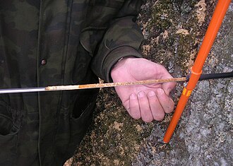
Geomorphologists are not limited to mapping. Geomorphologists also study paleoclimate, and the age of various landforms. One way in which these studies are conducted is through the sampling of tree rings. Trees grow one ring per year (allowing a total count of rings to give a precise age for any given tree), the width of those rings is subject to modification through variations in climate. Wetter, colder years result in thicker rings, and dryer, warmer years result in thinner rings. Tree ring samples are collected using an increment borer. It is essentially a hand crank drill that is also hollow, allowing a core to be removed instead of just sawdust. Using an increment borer is about as destructive to the tree as any boreing insect may be.